It seems to Oz, that life is nothing more than a grand diversion. On a trip to see buffalo at the Maxwell Game Reserve in McPherson County, Oz was diverted from his destination with a stop in Roxbury, Kansas.
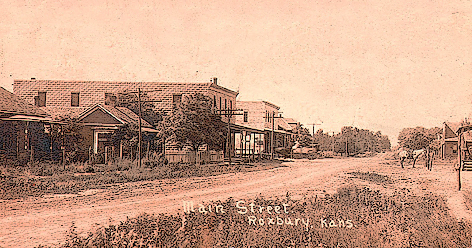
Roxbury, Kansas 1914, WSU special collections
The area is steeped in history.
In 1542, Francisco Vázquez de Coronado, having heard tales of the Seven Golden Cities of Cíbola, pawned his wife estates to finance a Quixotic quest to find these cities. Old wags claim that he discovered diamond fields on Gypsum Creek near Roxbury. Unfortunately for Coronado, and his wife, these turned out to gypsum deposits, a mineral we use today in drywall.
Coronado went home in disgrace, and once again became the land became the range of the buffalo and the hunting grounds of the Pawnee, Comanche, the Cheyenne and Arapaho Indians. After the Civil War, settlers came to McPherson County – Swedes to Lindsborg and Marquette, Mennonites to better farms to the south near Galva.
Gypsum Valley has few trees, the soil is sandy and loamy, there are creeks and some springs. This made the land suitable for buffalo, but less so for farming. Still settlers came, lured by cheap land and the chance of a new life. Look at the 1884 Gypsum Township map (or click on the link for a larger view) below and almost every single 160 acre plot of land is taken up by sturdy, tough farmers who came, built and farmed and ranched.
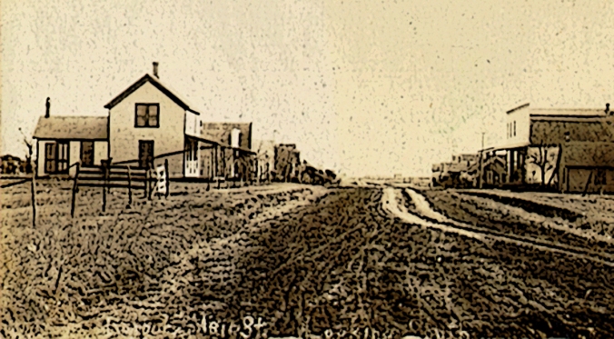
Roxbury, Kansas circa 1910
Gypsum Township has fewer people today than it did in 1884. Today 200 or so, souls call it home. Roxbury is the only town in the township. Its population peaked in 1910 at 100 and has gone downhill since. The empty grammar school and the high school are reminders of better days. On Main Street, a closed gas station and shuttered cafe are signs that most residents have moved on.
But not all.
A reader writes to say her great, great grandfather Joseph Jasper Writer came to the township in 1885 along with his wife Rachel Jane DeBolt and five-year-old daughter Bessie. They did quite well for themselves, within ten years paying off the mortgage, adding another daughter and son, and having need of a couple of farm hands.
One imagines they lived peacefully in a white farm house quite like that of Dorthy from the Wizard of Oz.
Away from the bottom land one finds the soil sandy and loamy the result of millions of years of wind and water erosion from the Rocky Mountains. Grass does well and so the buffalo loved grazing here once, but farming is always a gamble.
The name Roxbury intrigues Oz, and so he turns east off of I-135 on the Smoky Valley road near Lindsborg and travels 14 miles along the Prairie Trail Scenic Highway.
Roxbury, Kansas
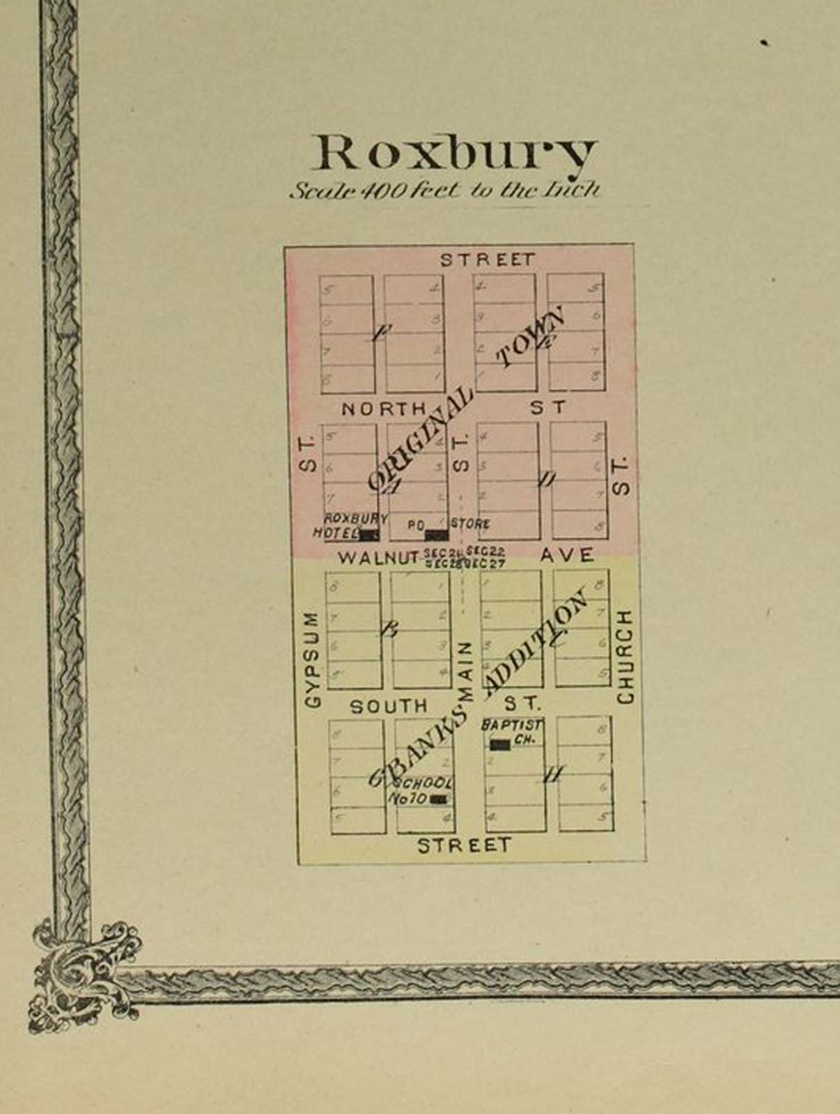
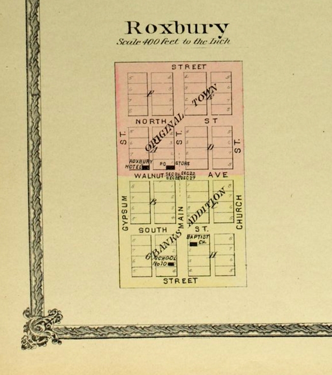
Later, Oz will find Edwards’ 1884 Atlas of McPherson County, Kansas and take his time looking at Gypsum Township and the plat map for Roxbury, a town of six streets, The east-west streets are North and South and Walnut in between, and, pointing north and south, Gypsum, Main, and Church, the three streets. There is a Roxbury Hotel on Walnut Street, but that is long gone. The general store and post office is on Walnut too, and I imagine that is what we are looking at in the 1910 image of the town above.
I ask Siri for information about the name Roxbury.
She tells me:
“Roxbury, England is a village in the North-West of England, 163 miles (262km) north west of London and east of Manchester.”
“Thanks Siri.”
I dig deeper into the remnants history leaves us and find that in 1630 English settlers arrived in Massachusetts and established Roxbury, as one of the first six towns, along with better known names like Boston and Cambridge. The First Church of Roxbury was the starting point for William Dawes’ less well-known “Midnight Ride” to warn the colonists of the British approach to Lexington and Concord on April 18, 1775. Maybe for that reason, the British liked to shell the town with canon fire.
What this has to do with our own Kansas Roxbury is unknown. It is just that I find history endlessly fascinating.
Saturday Night Live took up the name in a reoccurring skit called the Roxbury Guys and then a movie in 1998 called A Night at the Roxbury, made the name a household word, almost.
Then, Donald Trump gets in on the act in A Night at the Roxbury, courtesy of the Huffington Post.
https://www.facebook.com/HuffingtonPost/videos/10153263797116130/
Back to reality, ouch!
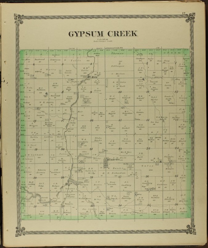
Gypsum Creek Township, click for larger view
There are no clues left behind on how Roxbury, Kansas got its name.
William G. Cutler mentions Roxbury in his History of the State of Kansas, McPerson County, 1884 , telling us only that:
“[It is] in the rich valley of Gypsum Creek. It contains a good store, post office, schoolhouse, church and other buildings. [A] Baptist Society was organized in 1872, and a good frame building, 30X40 feet, was completed in 1882, although it had been commenced in 1878.”
Even then we know Roxbury was in decline for there was no resident pastor for the registered flock of thirty souls; and the railroad passed north, west and south of town.
But these thirty souls were Donald Trump tough.
B. B. GATES had a farm and ran the general store in Roxbury, and possibly the hotel that show up on the atlas in 1884. He was originally from Connecticut, which is near enough to Roxbury, Massachusetts that we could give him credit for the name. James Muir, originally from Scotland, came in the summer of 1873 and took up farming and cattle raising, after first engaging in the business of hauling buffalo hides back east and return with general store goods. A. C. Spilman first came to Kansas in 1858 and fought with the Sixth Kansas Volunteer Calvary during the Civil War. In 1871, he settled near Roxbury and took up farming and cattle raising. Finally, there is Joseph Tolle who was first to settle near Roxbury, filing a claim on his land on May 4, 1866 and bringing his family on March 20, 1867 and surviving the Indian troubles that year.
One can pull up the Edwards Historical Atlas for McPherson County, 1884 and still find their names prominently across the township where Roxbury lies. Along Gypsum Creek, lie the holdings of Spilman, Muir, and Tolle. Upland in the sandy and loamy hills are the scattered holdings of B.B. Gates.
from Roxbury to Galva
The early settlers were tough and self-sufficient. Government subsidies were non-existent, survival depended on guts, determination and hard work.
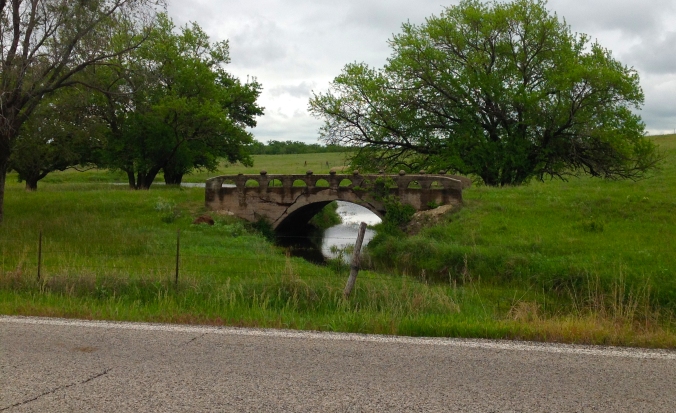
One last image of Roxbury comes while traveling south heading towards the Maxwell Game Reserve. It is an old bridge sitting off to the east of the road a couple of miles south of Roxbury, a concrete bridge that draws the mind back to a time long gone.
*Original image of Roxbury, Kansas 1910 from Wichita State University Archives.
